THEBESTINSPAIN.ES ≡ Victorian & Edwardian Reels Complement Alimentaire Dublin
  • Italy

  • Antique Map Germany West circa 1900

Antique Map Germany West circa 1900

$26.1 $48.55
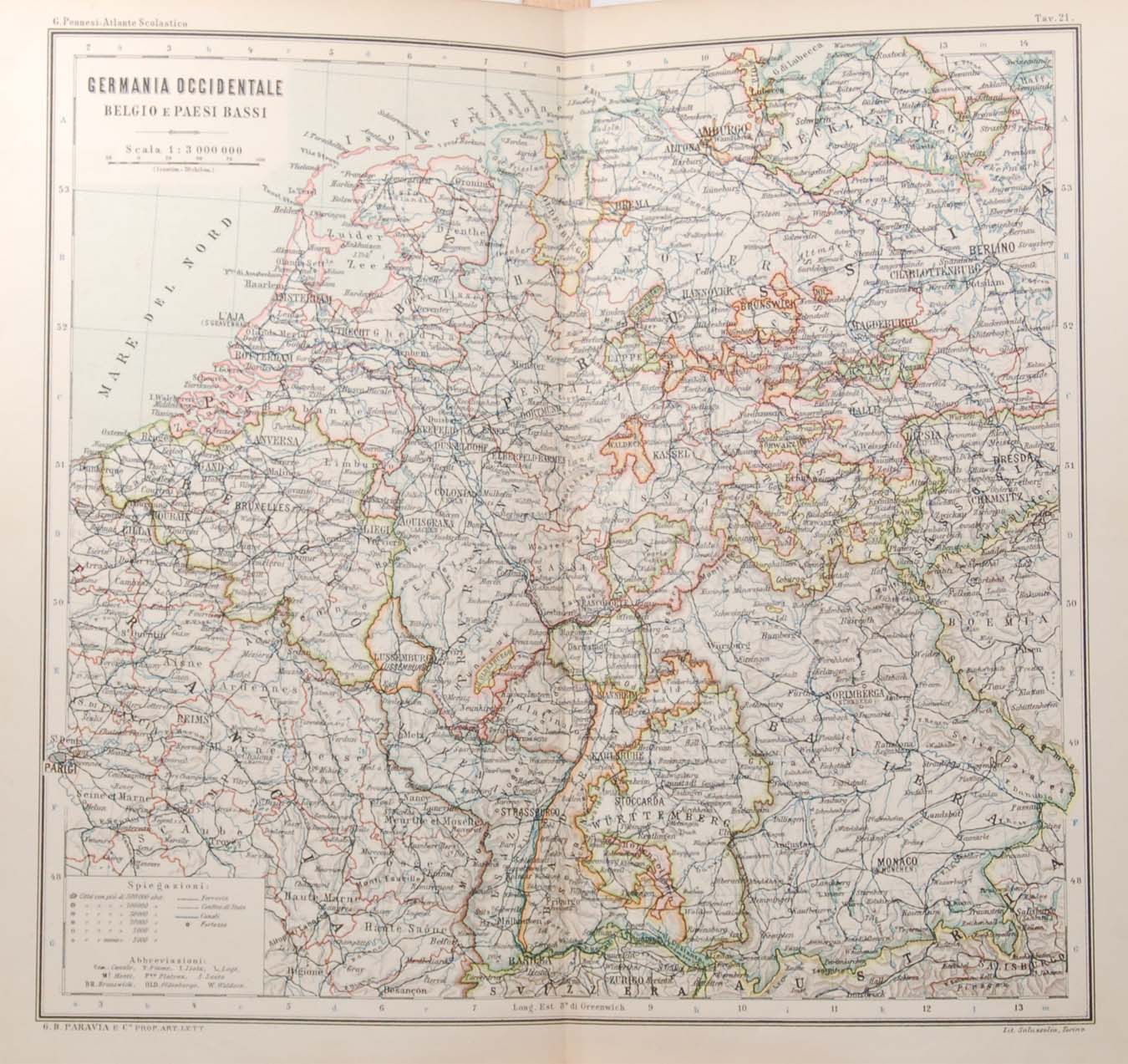
Antique colour map of Germany West and Belgium. The map was originally printed in Italy and is titled Germania Occidentale Belgio e Paesi Basi. It was printed in Italy by Ditta G B Paravia E Comp. Map dates from the early 1900’s, original owners notes for the full set referencing 1901 to 1904. Condition wise the map is in very good condition for it’s age, it is a fold out map so fold lines are present, some paper separation at folds to Morocco, map will have age related toning to paper. The map is large 12 by 13 inches in total, map size 11 by 10 1/2 inches, good border for framing. These type of maps have a spine at the back which should be kept on when framing.
Italy

Italy

  • Antique Map 1851 Italy
    $31.5 $58.91
  • Rovine Antiche sotto il Monte Aventino 1830
    $26.96 $48.79
  • Piazza di S Giovanni in Laterano Antique Print 1830
    $17.95 $34.29
  • Antique Map The Alps circa 1900
    $35.1 $55.81
  • Antique Map The Mediterranean Sea circa 1900
    $35.1 $64.23
  • Antique Map Europe circa 1900
    $35.1 $45.63
  • Porto Maggiore Rome Antique Print 1830
    $22.5 $42.3
  • Piazza Colonnal Rome Antique Print 1830
    $22.5 $30.83
  • Antique Map Russia Europe Physical circa 1900
    $35.1 $44.58
  • Antique Map 1851 Italy par Meridionalis
    $31.5 $47.57
  • Arco di Giano Quadrifronte
    $17.95 $32.32
  • Tempio del Dio Redicolo Antique Print 1830
    $17.95 $27.83
  • Antique Map Germany West circa 1900
    $26.1 $48.55
  • Antique Map Iberian Peninsula circa 1900
    $35.1 $44.58
  • Scolastica Presso Subiaco Antique Print 1830
    $13.5 $19.58
  • Basilica di S. Giovanni in Laterano
    $17.95 $27.29

© 2026 - THEBESTINSPAIN.ES