THEBESTINSPAIN.ES ≡ Victorian & Edwardian Reels Complement Alimentaire Dublin
  • Middle East

  • Forty Year Journey of the Israelites 1840 Maps

Forty Year Journey of the Israelites 1840 Maps

$44.96 $66.08
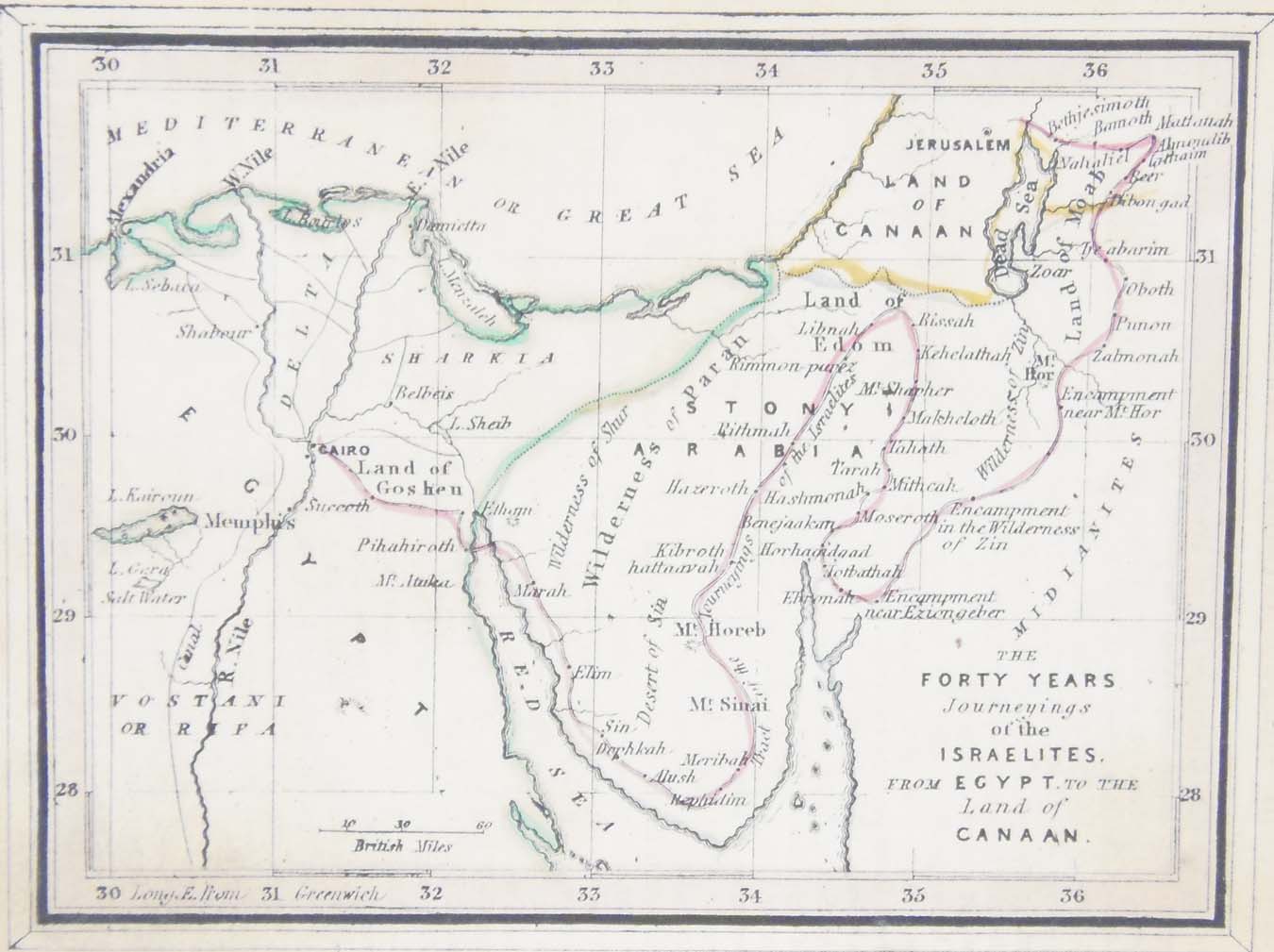
Pair of antique maps with colour outline titled, The Forty years journeyings of the Israelites from Egypt to the land of Canaan. Palestine or the Holy Land. The maps where drawn and engraved by William Murphy and published by Oliver and Boyd. Part of a larger set of maps, the overall work being commended by Archibald Bennie, Minister of Lady Yester on the 24th June 1840. The maps are 5 1/2 by 4 1/4 inches and are in very good condition for age, paper will show ageing and marking.
Middle East

Middle East

  • 1844 Mount of Olives from the Wall
    $35.1 $43.52
  • Jerusalem Antique Map 1844
    $80.96 $134.39
  • 1844 Garden of Gethsemane
    $26.1 $39.15
  • 1844 Jerusalem from the Mount of Olives
    $62.1 $74.52
  • 1844 Jerusalem as besieged by Titus
    $62.1 $90.05
  • 1844 Jerusalem from the North East
    $35.1 $61.43
  • Antique Map 1851 Syria
    $31.5 $49.77
  • Forty Year Journey of the Israelites 1840 Maps
    $44.96 $66.08
  • Tribes of Rueben and Zebulun 1840 Maps
    $44.96 $71.03
  • Tribes of Simeon and Benjamin 1840 Maps
    $44.96 $64.74
  • Antique Map 1851 Oriens
    $31.5 $49.14
  • Tribe of Manasseh 1840 Maps
    $44.96 $66.53
  • Pair 1840 Plans Jerusalem
    $53.96 $74.46

© 2026 - THEBESTINSPAIN.ES