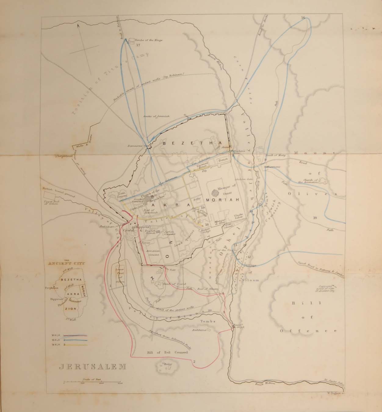
Antique map of Jerusalem published in 1844. The map was done by William Hughes and was originally part of a larger publication by W H Bartlett looking at walks in Jerusalem and it’s environs. The map show three routes around the city, each with a colour outline. The map is now very hard to find. The map was released as a fold out map, so fold lines are present. It is in very good condition for age, small patches of foxing and marking mainly out side map area. Small paper split on one fold away from both map and plate area. Please see pictures. The paper area of the map is 11 1/2 by 9 1/4 inches. the plate mark area is 8 by 10 inches with the map being 7 by 9 inches. Due to the maps age and it’s rarity, we would recommend using a local framer to mount and frame the map rather than off the shelf products.
Este método no permite hacer pagos mayores a 500 por día
Debes escanear el código QR, haz clic en «Continuar» para adjuntar la captura de pantalla (es el único comprobante de pago) y podrás completar la compra.