Product on sale
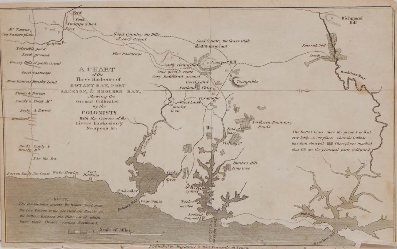
Chart of the Three Harbours of Botany Bay 1818
- Estimated Delivery : Up to 4 business days
- Free Shipping & Returns : On all orders over RM200
1818 copper engraving titled A chart of the three Harbours of Botany Bay, Port Jackson, & Brocken Bay, showing the ground cultivated by the colonists with the courses of the river Hawkesbury. The print was originally released as part of the Collection of the most celebrated Voyages & Travels from the Discovery of America by R P Forster Esq. It was published in 1818 in Newcastle upon Tyne, England by Mackenzie and Dent. The plan measures 5 by 8 inches. The plan is in good overall condition for it’s age, paper shows ageing and small amount of foxing. Paper turn at top right outside of map border. Bottom of paper his bumped, some small paper tears below border, bottom left turn and paper tear to start of map. Please see pictures.
Related products
-
Crystal Globe Teamwork Award
$ 91.07 -
Rosewood Silver Star Trophy
$ 67.50 -
Crystal Keepsake Box
$ 43.65 -
Gold Star Award On Rosewood
$ 88.65 -
14″ Wine Cooler Trophy
$ 96.81